|
Alberta Highway 55
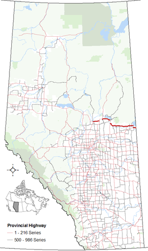
Alberta Provincial Highway No. 55, commonly referred to as Highway 55, is a 263-kilometre (163 mi) long east–west highway in northeast Alberta, Canada.[2] It extends from the Saskatchewan border in the east through the Cold Lake, Lac La Biche, and Athabasca where it ends at Highway 2. In Saskatchewan, it continues as Saskatchewan Highway 55.[3][1] The entire length of Highway 55 comprises the easternmost segment of Alberta's portion of the Northern Woods and Water Route (NWWR). West of Athabasca, the Northern Woods and Water Route continues westward along Highway 2 and then Highway 49. HistoryThe original designation Highway 55 was a 15-kilometre (9 mi) long north-south highway that appeared on maps in the mid-1950s and connected Fort Saskatchewan with Highway 16, just east of Edmonton.[4] In 1973, Alberta established its secondary highway system along mostly existing unimproved roads, with Secondary Highway 662 running between Highway 36 and Cold Lake, and Secondary Highway 664 running between Athabasca and Donatville. The idea of a northern highway corridor between Dawson Creek, British Columbia and Winnipeg, Manitoba was originally lobbied by George Stevenson, a retired CN employee who lived in McLennan, Alberta. The communities along the proposed corridor supported his idea and eventually resulted in the incorporation of the Northern Woods and Water Route Association in the western provinces 1974.[5] As part of establishing the corridor in northeastern Alberta, two secondary highways (662 and 664), along with Highway 28X and a portion of Highway 46 were renumbered to Highway 55 in c. 1977, matching Saskatchewan Highway 55, while the original route east of Edmonton became part of Highway 21.[6][7] Highway 55 was paved throughout the 1980s.[8]
Major intersectionsFrom west to east:
References
External linksKML is not from Wikidata
|
|||||||||||||||||||||||||||||||||||||||||||||||||||||||||||||||||||||||||||||||||||||||||||||||||||||||||||||||||||||||||||||||||||||||||||||||||||||||||||||||||||||||||||||||||||||||||||||||||||||||||||||||||||||||||||


