Share to:


Braine-le-Château

Braine-le-Château
Brinne-Tchestea (Walloon)
Kasteelbrakel (Dutch)
Braine-le-Château: the castle
Flag of Braine-le-Château
Coat of arms of Braine-le-Château
Location of Braine-le-Château
Map
Braine-le-Château is located in Belgium
Braine-le-Château
Braine-le-Château
Location in Belgium
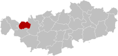
The municipality of Braine-le-Château in Walloon Brabant
Coordinates: 50°41′N 04°16′E / 50.683°N 4.267°E / 50.683; 4.267
Country Belgium
CommunityFrench Community
RegionWallonia
ProvinceWalloon Brabant
ArrondissementNivelles
Government
 • MayorNicolas Tamigniau (RB)
 • Governing party/iesRenouveau Brainois (RB)
Area
 • Total
22.75 km2 (8.78 sq mi)
Population
 (2018-01-01)[1]
 • Total
10,447
 • Density460/km2 (1,200/sq mi)
Postal codes
1440
NIS code
25015
Area codes02
Websitewww.braine-le-chateau.be

Braine-le-Château (French: [bʁɛn ʃɑto] ; Walloon: Brinne-Tchestea; Dutch: Kasteelbrakel [kɑˈsteːlˌbraːkəl]) is a municipality of Wallonia located in the Belgian province of Walloon Brabant.

On January 1, 2006, Braine-le-Château had a total population of 9,446. The total area is 22.70 km² which gives a population density of 416 inhabitants per km².

The municipality consists of the following districts: Braine-le-Château and Wauthier-Braine, which were municipalities of their own until 1977.

Braine-le-Château is a medieval village in which remain many buildings from the Middle Ages. Among them are the pillory (1521), the village mill (c. 1200) and the Maison du Bailli (c. 1535).

References

  1. ^ "Wettelijke Bevolking per gemeente op 1 januari 2018". Statbel. Retrieved 9 March 2019.


Kembali kehalaman sebelumnya