|
Capron, Illinois
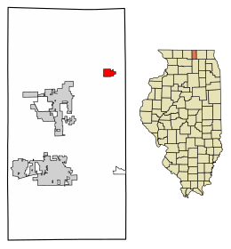
Capron is a village in Boone County, Illinois, United States. It is part of the Rockford, Illinois Metropolitan Statistical Area. The population was 1,395 at the 2020 census, up from 1,376 at the 2010 census. HistoryThe oldest known structure in the area, now known as the Capron Lutheran Church, was built in 1844.[3] Once known as Hebron Station along the Chicago and North Western Railroad, the town was renamed in 1874 to honor Colonel John Capron who would pass only four years later.[4] Capron was officially incorporated as a village in 1887. GeographyCapron is located at 42°23′52″N 88°44′23″W / 42.39778°N 88.73972°W (42.397729, -88.739684).[5] According to the 2021 census gazetteer files, Capron has a total area of 0.77 square miles (1.99 km2), of which 0.77 square miles (1.99 km2) (or 99.87%) is land and 0.00 square miles (0.00 km2) (or 0.13%) is water.[6] Route 173 runs through the town. Demographics
As of the 2020 census[8] there were 1,395 people, 477 households, and 351 families residing in the village. The population density was 1,814.04 inhabitants per square mile (700.40/km2). There were 497 housing units at an average density of 646.29 per square mile (249.53/km2). The racial makeup of the village was 59.93% White, 1.15% African American, 0.79% Native American, 0.22% Asian, 0.00% Pacific Islander, 22.37% from other races, and 15.56% from two or more races. Hispanic or Latino of any race were 40.93% of the population. There were 477 households, out of which 43.6% had children under the age of 18 living with them, 46.54% were married couples living together, 16.56% had a female householder with no husband present, and 26.42% were non-families. 17.61% of all households were made up of individuals, and 7.76% had someone living alone who was 65 years of age or older. The average household size was 3.93 and the average family size was 3.47. The village's age distribution consisted of 29.1% under the age of 18, 10.7% from 18 to 24, 28.6% from 25 to 44, 24.1% from 45 to 64, and 7.5% who were 65 years of age or older. The median age was 30.9 years. For every 100 females, there were 113.7 males. For every 100 females age 18 and over, there were 99.3 males. The median income for a household in the village was $67,316, and the median income for a family was $76,250. Males had a median income of $41,250 versus $23,568 for females. The per capita income for the village was $23,843. About 9.4% of families and 11.1% of the population were below the poverty line, including 14.0% of those under age 18 and 16.8% of those age 65 or over. References
|
||||||||||||||||||||||||||||||||||||||||||||||||||||||||||||||||||||||||||||||||||||||||||||||||||||||||||||||||||


