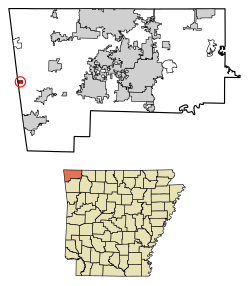
Census-designated place in Arkansas, United States
Cherokee City is an unincorporated census-designated place (CDP) in Benton County , Arkansas , United States. Per the 2020 census , the population was 73.[ 3] Coon Creek Bridge , which is located on Cty Rd. 24 and is listed on the National Register of Historic Places .[ 4] Cherokee , since the Trail of Tears crossed the landscape when the Cherokee migrated west to Indian territory , now Oklahoma in the late 1830s. The town is within the Northwest Arkansas region, located about 5 miles east of Oklahoma and 4 miles south of the Missouri state line.
Demographics
Historical population
Census Pop. Note %± 2010 72 — 2020 73 1.4%
2020 census
Cherokee City CDP, Arkansas – Racial and ethnic composition Note: the US Census treats Hispanic/Latino as an ethnic category. This table excludes Latinos from the racial categories and assigns them to a separate category. Hispanics/Latinos may be of any race.
Race / Ethnicity (NH = Non-Hispanic )
Pop 2010[ 6]
Pop 2020[ 7]
% 2010
% 2020
White alone (NH)
64
51
88.89%
69.86%
Black or African American alone (NH)
0
2
0.00%
2.74%
Native American or Alaska Native alone (NH)
4
2
5.56%
2.74%
Asian alone (NH)
0
3
0.00%
4.11%
Pacific Islander alone (NH)
0
0
0.00%
0.00%
Some Other Race alone (NH)
0
0
0.00%
0.00%
Mixed Race or Multi-Racial (NH)
2
10
2.78%
13.70%
Hispanic or Latino (any race)
2
5
2.78%
6.85%
Total
72
73
100.00%
100.00%
History
Cherokee City was platted in 1880.[ 8] [ 9]
Education
Public education is available from the Gentry School District ,[ 10] Gentry High School .
References
^ "2020 U.S. Gazetteer Files" . United States Census Bureau. Retrieved October 29, 2021 .^ a b U.S. Geological Survey Geographic Names Information System: Cherokee City, Arkansas ^ "Cherokee City CDP, Arkansas" . United States Census Bureau . Retrieved April 15, 2022 .^ "National Register Information System" . National Register of Historic Places National Park Service . March 13, 2009.^ "Decennial Census of Population and Housing by Decades" . US Census Bureau .^ a b "P2 Hispanic or Latino, and Not Hispanic or Latino by Race – 2010: DEC Redistricting Data (PL 94-171) – Cherokee City CDP, Arkansas" . United States Census Bureau ^ a b "P2 Hispanic or Latino, and Not Hispanic or Latino by Race – 2020: DEC Redistricting Data (PL 94-171) – Cherokee City CDP, Arkansas" . United States Census Bureau ^ History of Benton, Washington, Carroll, Madison, Crawford, Franklin, and Sebastian Counties, Arkansas ^ "Post Offices" . Jim Forte Postal History. Retrieved January 5, 2017 .^ "2020 CENSUS - SCHOOL DISTRICT REFERENCE MAP: Benton County, AR" (PDF) . U.S. Census Bureau . Retrieved May 25, 2022 .
36°17′54″N 94°34′40″W / 36.29833°N 94.57778°W / 36.29833; -94.57778


