|
Dwarahat
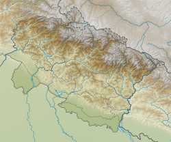
Dwarahat is a town in the Almora district of Uttarakhand, India. Situated at an elevation of 1,510 meters (4,950 feet) in the Kumaon region, Dwarahat is known for its cultural heritage and historical significance, particularly related to the ancient Katyuri dynasty which ruled the region from the 7th to the 11th century.[citation needed] GeographyDwarahat is located at 29°47′N 79°26′E / 29.78°N 79.43°E.[1] DemographicsDwarahat is a Nagar Panchayat city in district of Almora, Uttarakhand. The Dwarahat city is divided into 4 wards for which elections are held every 5 years. The Dwarahat Nagar Panchayat has a population of 2,749 of which 1,378 are males while 1,371 are females as per a report released by Census India 2011. The population of Children with age 0-6 is 310 which is 11.28% of the total population of Dwarahat (NP). In Dwarahat Nagar Panchayat, Female Sex Ratio is of 995 against the state average of 963. Moreover, Child Sex Ratio in Dwarahat is around 813 compared to the Uttarakhand state average of 890. The literacy rate of Dwarahat City is 92.82% higher than the state average of 78.82%. In Dwarahat, Male literacy is around 96.93% while female literacy rate is 88.80%. Dwarahat Nagar Panchayat has a total administration of over 668 houses to which it supplies basic amenities like water and sewerage. It is also authorized to build roads within Nagar Panchayat limits and impose taxes on properties coming under its jurisdiction. EducationA Government Engineering College Bipin Tripathi Kumaon Institute of Technology was established in 1991 in Dwarahat. A Polytechnic College, PG College, Dwarahat Inter College Dwarahat, Govt. Inter college, Government Girls Inter College, M.D. Tiwari High School Dwarahat, Dunagiri Modern School, Dr Leeladhar Bhatt Vivekanand Vidya Mandir Inter College Dwarahat, Kumaon Public School Dwarahat, Universal Convent School Dwarahat, and Saraswati Shishu Mandir Dwarahat are situated here. CultureDwarahat is also known as Sanskritik Nagari (Cultural heritage) where many temples were constructed by Katyuri Kings in the 7th to 11th Century (Which has as many as 55 ancient temples). Dwarahat is also known as the branch ashram of the Yogoda Satsanga Society of India, known as Yogoda Satsanga Sakha Ashram, Dwarahat. It carries on many charitable activities including eye camps and a school, plus teaches Kriya Yoga. There are hundreds of big & small temples in Dwarahat. Dunagiri Temple is the most famous among them. There is also a Kedarnath and a Badrinath temple there, which was constructed by Katyuri kings. Ratandev, Maha Mrityunjay, Gurjardev, and other temples were also constructed by the Katyuris. ReferencesExternal links
|
||||||||||||||||||||||||||||||||||


