|
Greek National Road 2

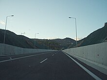
Greek National Road 2 (Greek: Εθνική Οδός 2, abbreviated as EO2) is a single carriageway with at-grade intersections, located in the regions of West Macedonia, Central Macedonia and East Macedonia and Thrace. It connects the Albanian border near Florina with the Turkish border near Alexandroupoli. Its section east of Thessaloniki has been replaced by the new A2 motorway (Egnatia Odos). The section between the Albanian border and Thessaloniki is part of European route E86. RouteThe EO2 is officially defined as an east-west route through northwestern Greece, southern Macedonia and southern Thrace, between the Albania–Greece border to the west near Krystallopigi, and the Greece–Turkey border to the east at Kipoi:[1] in practice, the EO2 is split into two parts by the A2 motorway (Egnatia Odos) replacing the segment between Efkarpia and Lagyna. The western section (Krystallopigi–Efkarpia) passes through Vatochori, Pisoderi, Florina, Edessa, Giannitsa, Chalkidona and Thessaloniki; The eastern section (Lagyna–Kipoi) passes through Lagkadikia, Amphipolis, Kavala, Toxotes, Xanthi, Lagos, Komotini, Mesti, Alexandroupolis, Feres and Ardani. The EO2 overlaps with the EO15 from Vatochori to Trigono, with the EO3 from Agios Athanasios to Vevi, and with the EO1 Chalkidona to Gefyra.[1] In addition to replacing a small part of the EO2 north of Thessaloniki, the A2 motorway also provides a faster route than the EO2 between Thessaloniki and Kipoi. Since 1975, the EO2 formed part of the European route E86 from Krystallopigi to Gefyra,[2] although the section between Gefyra and Thessaloniki was dropped in October 2000.[3] HistoryMinisterial Decision G25871 of 9 July 1963 created the current EO2 from all or part of the following short-lived national roads (listed from west to east), which existed by royal decree from 1955 to 1963:[4][1]
Until 1975, the EO2 formed part of the old European route E20 from the Albania–Greece border at Krystallopigi to Lagyna (north of Thessaloniki), and the old E5 from Gefyra to the Greece–Turkey border at Kipoi: hence, the old E5 and E20 overlaps between Gefyra and Lagyna.[5] References
40°45′31″N 22°30′11″E / 40.7587°N 22.5031°E
|
||||||||||||||||||||||||||||||||


