Share to:


Hainshallig

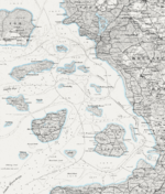
1858 map of North Frisian islands, including Hainshallig

Hainshallig (also spelled Hayenshallig) was a small Hallig in the North Frisian Wadden Sea, located east of the Hallig of Hooge, that was flooded and sank in 1860.[1] At the time, Hainshallig was leased to a Hooge resident as part of a leasehold estate and was used for the production of hay.[2] A levee may have once led from Hooge to Hainshallig.[3] The area belonged to the Duchy of Schleswig, which was a fiefdom of the Danish crown, now Germany.

References

  1. ^ Röhr, Hanswerner. "Die Halligen an der Westküste gelten vorerst als sicher" (PDF). Berichte und Geschichte aus Husum und Umgebung (in German). Archived from the original (PDF) on 2014-02-21. Retrieved 2012-04-01.
  2. ^ Ersch, Johann Samuel (1833). Allgemeine Encyclopädie der Wissenschaften und Künste in alphabetischer Folge (in German). Leipzig, J.F. Gleditsch.
  3. ^ Hanssen, Georg (1884). Agrarhistorische Abhandlungen. Vol. 2.

54°34′24″N 8°36′31″E / 54.573355°N 8.608475°E / 54.573355; 8.608475


Kembali kehalaman sebelumnya