|
Mount Pleasant Township, Adams County, Pennsylvania
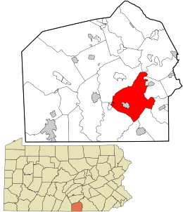
Mount Pleasant Township is a township that is located in Adams County, Pennsylvania, United States. As of the 2010 census, the township population was 4,693.[3] It includes an exclave of the Gettysburg National Military Park.[4] GeographyAccording to the United States Census Bureau, the township has a total area of 30.6 square miles (79.2 km2), of which 30.4 square miles (78.8 km2) is land and 0.15 square miles (0.4 km2), or 0.56%, is water.[3] Demographics
As of the census[6] of 2000, there were 4,420 people, 1,616 households, and 1,258 families residing in the township. The population density was 144.3 inhabitants per square mile (55.7/km2). There were 1,681 housing units at an average density of 54.9 per square mile (21.2/km2). The racial makeup of the township was 98.44% White, 0.43% African American, 0.14% Native American, 0.38% Asian, 0.34% from other races, and 0.27% from two or more races. Hispanic or Latino of any race were 1.70% of the population. There were 1,616 households, out of which 36.6% had children under the age of eighteen living with them; 65.6% were married couples living together, 6.7% had a female householder with no husband present, and 22.1% were non-families. 17.6% of all households were made up of individuals, and 7.4% had someone living alone who was sixty-five years of age or older. The average household size was 2.74 and the average family size was 3.08. Within the township, the population was spread out, with 26.8% of residents who were under the age of eighteen, 7.6% who were aged eighteen to twenty-four, 29.9% who were aged twenty-five to forty-four, 23.9% who were aged forty-five to sixty-four, and 11.8% who were sixty-five years of age or older. The median age was thirty-seven years. For every one hundred females there were 100.6 males. For every one hundred females who were aged eighteen or older, there were 98.2 males. The median income for a household in the township was $41,132, and the median income for a family was $44,619. Males had a median income of $30,313 compared with that of $21,806 for females. The per capita income for the township was $16,913. Approximately 7.2% of families and 9.9% of the population were living below the poverty line, including 17.2% of those who were under the age of eighteen and 5.5% of those who were aged sixty-five or older. EducationMost of the township is in the Conewago Valley School District, while a piece is in the Littlestown Area School District.[7] References
|
||||||||||||||||||||||||||||||||||||||||||||||||||||||||||||||||||||


