|
Redang Island
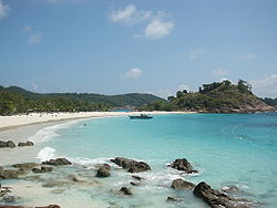
Redang Island (Malay: Pulau Redang, Terengganu Malay: Pula Redang) is an island in Kuala Nerus District, Terengganu, Malaysia. It is one of the largest islands off the east coast of Peninsular Malaysia and one of the most beautiful islands in the world[citation needed]. It is famous for its crystal clear waters and white sandy beaches. It is one of nine islands that made up an eponymous marine sanctuary park offering snorkeling and diving opportunities for tourists. GeographyGeographically, Redang Island has an area of about 24 km2 (9.3 sq mi) and measures about 7 km (4.3 mi) long and 6 km (3.7 mi) wide. Its highest peak is Bukit Besar at 359 metres (1,178 feet) above sea level. For land administration purpose, 18 islands including Redang Island form the Redang Islands Mukim of the Kuala Nerus District. Of these, 7 islands were protected and gazetted as marine parks by the Department of Fisheries and zoned 2 nautical miles (3.7 km) from the shore at lowest tide.[1][2][3] As with other mukims of Kuala Nerus District, it was a part of the Kuala Terengganu District until 2014.
Note: ^[a] Islands designated as marine parks. Tourism In contrast to the neighbouring Perhentian Islands, Redang has a more upmarket image, as almost all accommodation on the island is resort-based. The largest beach is Pasir Panjang on the east side, featuring half a dozen resorts. The beach is covered with soft white sand. Coral and fish can be seen just a few metres from the beach. The other beach resorts are located in Teluk Dalam on the north and Teluk Kalong to the south. The 2000 film, Summer Holiday was filmed on the Laguna Redang Island Resort, and a replica of the tea house now serves as the resort's gift shop. The island is a turtle nesting site, and these turtles serve as a draw for ecotourism.[4] ClimateRedang has a tropical climate with temperatures steadily around 30 °C (86 °F) and frequent but brief thunderstorms. Like the rest of Malaysia's east coast, Redang is affected by the northeast monsoon from the South China Sea, so most resorts are closed and ferry transport schedules are severely restricted between October and March. The amount of monthly rainfall varies throughout the year, with November to February being the wettest months, whilst April to August being the driest. The island experiences on average about 2,600 millimetres (100 in) of rain per year.
TransportationBy sea, access to the island is from Merang or Shahbandar jetty on boats operated by the resorts. For air travel, SKS Airways also provides daily scheduled flights from Subang Airport. Berjaya Air is also available for charter flights to the island from both Subang Airport and Singapore's Seletar Airport. Redang Airport, the island's primary STOL airport lies to the south of the island. FeaturesSee alsoReferences
External links
Wikivoyage has a travel guide for Redang.
|
||||||||||||||||||||||||||||||||||||||||||||||||||||||||||||||||||||||||||||||||||||||||||||||||||||||||||||||||||||||||||||||||||||||||||||||||||||||||||||||||||||||||||||||||||||||||||||||||||||||||||||||||||||||||||||||||||||||||||||||


