Share to:


Ridder, Kazakhstan

Ridder
Риддер
Official seal of Ridder
Image of Ridder taken from the International Space Station
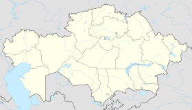
Ridder is located in Kazakhstan
Ridder
Ridder
Location in Kazakhstan
Coordinates: 50°21′N 83°31′E / 50.350°N 83.517°E / 50.350; 83.517
Country Kazakhstan
RegionEast Kazakhstan Region
FoundedMay 31, 1786
Incorporated (city)February 10, 1934
Government
 • Akim (mayor)Duman Rakhmetkaliev [1]
Elevation
730 m (2,400 ft)
Population
 (2009)
 • Total
50,500
Time zoneUTC+6
Area code+7 72336

Ridder (Kazakh: Риддер, romanizedRidder), formerly known as Leninogorsk (Russian: Лениногорск) is a city in the East Kazakhstan Region in north-eastern Kazakhstan. Its population is approximately 50,500 (2009 Census results).[2] The city is situated in the south-western Altai Mountains and north-east of the region's capital, Oskemen, along the Ulba River, at an elevation higher than 700 metres.[3] Ridder is the source of the E40 motorway.

History

The fact that Altai Krai is rich in natural deposits was discovered during Empress Catherine the Great's reign. The history of Ridder started in 1786 when 9 troops of men were sent to the Altai region to search for natural resource deposits. One of these troops was headed by an officer, Philip Ridder. On May 31, 1786, he found a very rich deposit containing gold, silver and other metals.[4]

The same year, in summer, the settlement was founded there and it was named Riddersky pit. This was how the city was founded. The unique ores of the Riddersky deposit were noted by specialists of various levels and commissions. The deposit became known far beyond Russia. In 1850, Riddersky ores received the highest appreciation at The Great Exhibition in London. In 1879 the samples were included into the museum collection of the Stockholm Royal Technical Institute.

During the early 20th century Ridder experienced a number of foreign concessions, revolution and Civil war. On February 10, 1934, the settlement of Ridder was designated a town.[5] In 1941, just before Hitler invaded the Soviet Union, the town of Ridder was renamed to Leninogorsk (in honour of Lenin).

During the Soviet period, Leninogorsk saw significant industrial growth. Several plants were constructed - the lead plant was one of the first plants for the non-ferrous industry in Kazakhstan, while Leninogorsky cascade hydro power station was the only one in Kazakhstan and the second one in Soviet Union. Several other mines and factories, including the zinc plant, were built and the college of mining and metallurgy was opened in this period.

During World War II Leninogorsk produced about 50% of the high-quality lead in the whole Soviet Union. In 2002 the city received back its original name - Ridder.[6]

Economy

Ridder is a center of mining operations and processing of nonferrous metals. Other branches of industry include wood and textile industry, food production, and mechanical engineering.

Transport

The European route E40, originating in Calais, France, has its eastern terminus in Ridder. Over 8,000 kilometres (5,000 mi) long, it is the longest European route.

Climate

Ridder has a warm-summer humid continental climate (Köppen climate classification Dfb) with mild summers and very cold winters.

Climate data for Ridder (1991–2020, extremes 1951–present)
Month Jan Feb Mar Apr May Jun Jul Aug Sep Oct Nov Dec Year
Record high °C (°F) 12.6
(54.7)
12.3
(54.1)
21.1
(70.0)
28.4
(83.1)
34.2
(93.6)
34.6
(94.3)
37.0
(98.6)
35.7
(96.3)
34.3
(93.7)
26.2
(79.2)
20.7
(69.3)
12.0
(53.6)
37.0
(98.6)
Mean daily maximum °C (°F) −6.6
(20.1)
−3.8
(25.2)
2.5
(36.5)
11.2
(52.2)
18.1
(64.6)
22.8
(73.0)
24.2
(75.6)
23.1
(73.6)
17.2
(63.0)
9.9
(49.8)
0.1
(32.2)
−5.3
(22.5)
9.5
(49.0)
Daily mean °C (°F) −12.8
(9.0)
−10.7
(12.7)
−4.3
(24.3)
4.6
(40.3)
11.1
(52.0)
15.9
(60.6)
17.5
(63.5)
15.7
(60.3)
9.9
(49.8)
3.4
(38.1)
−5.7
(21.7)
−10.7
(12.7)
2.8
(37.1)
Mean daily minimum °C (°F) −18.1
(−0.6)
−16.9
(1.6)
−10.6
(12.9)
−2.0
(28.4)
3.9
(39.0)
9.0
(48.2)
11.1
(52.0)
8.7
(47.7)
3.0
(37.4)
−2.0
(28.4)
−10.6
(12.9)
−15.6
(3.9)
−3.3
(26.0)
Record low °C (°F) −45.4
(−49.7)
−41.0
(−41.8)
−37.2
(−35.0)
−24.0
(−11.2)
−12.2
(10.0)
−2.8
(27.0)
2.1
(35.8)
−2.0
(28.4)
−11.7
(10.9)
−23.3
(−9.9)
−47
(−53)
−40.9
(−41.6)
−47.0
(−52.6)
Average precipitation mm (inches) 19
(0.7)
22
(0.9)
35
(1.4)
60
(2.4)
75
(3.0)
78
(3.1)
85
(3.3)
63
(2.5)
56
(2.2)
62
(2.4)
51
(2.0)
33
(1.3)
639
(25.2)
Average precipitation days (≥ 1.0 mm) 5.7 5.9 7.4 8.9 9.9 10.2 11.4 8.6 8.3 10.0 9.1 8.6 104.0
Average relative humidity (%) 73 68 70 67 63 62 68 67 67 69 74 75 69
Mean monthly sunshine hours 100 135 201 232 278 300 313 283 222 140 105 89 2,398
Mean daily sunshine hours 3.2 4.8 6.5 7.7 9.0 10.0 10.1 9.1 7.4 4.5 3.5 2.9 6.6
Source 1: Pogoda.ru.net[7]
Source 2: NOAA (sun, 1961–1990),[8][9] Deutscher Wetterdienst (humidity 1991-2001, daily sun 1961-1990)[10]

Ethnic Composition

Points of interest

Points of interest include a local museum and a botanical garden.

Sports

In March 2013, Ridder hosted the World Ski Orienteering Championships.

Notable person

Oleg Boltin, professional wrestler

References

  1. ^ "Назначен новый аким Риддера". www.zakon.kz (in Russian). 2024-06-24.
  2. ^ "Население Республики Казахстан" [Population of the Republic of Kazakhstan] (in Russian). Департамент социальной и демографической статистики. Retrieved 8 December 2013.
  3. ^ "Ridder City, Kazakhstan". Britannica.com. Retrieved February 13, 2014.
  4. ^ "Ridder City, Kazakhstan". AboutKazakhstan.com. Retrieved February 13, 2014.
  5. ^ "Постановление ВЦИК от 10.02.1934 Об утверждении дополнительного списка городов и рабочих поселков Казакской АССР — Викитека". ru.wikisource.org (in Russian). Retrieved 2023-09-16.
  6. ^ "Town of Leninogorsk, Kazakhstan to regain historic name - Ridder". Pravda. June 11, 2002. Retrieved February 13, 2014.
  7. ^ "Weather and Climate - The Climate of Ridder" (in Russian). Weather and Climate (Погода и климат). Retrieved 15 December 2021.
  8. ^ "Leninogorsk (Ridder) Climate Normals 1961–1990". National Oceanic and Atmospheric Administration. Retrieved 5 January 2022.
  9. ^ "Leninogorsk (Ridder) Climate Normals 1991–2020". National Oceanic and Atmospheric Administration. November 2011. Retrieved 1 November 2023.
  10. ^ "Klimatafel von Leninogorsk / Kasachstan" (PDF). Federal Ministry of Transport and Digital Infrastructure. Retrieved September 17, 2016.
Kembali kehalaman sebelumnya