Share to:


Sarıkamış-Allahuekber Mountains National Park

Sarıkamış-Allahuekber Mountains National Park
Sarıkamış-Allahuekber Dağları Milli Parkı
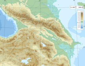
Map showing the location of Sarıkamış-Allahuekber Mountains National Park
Sarıkamış-Allahuekber Mountains NP
Map showing the location of Sarıkamış-Allahuekber Mountains National Park
Sarıkamış-Allahuekber Mountains NP
Map showing the location of Sarıkamış-Allahuekber Mountains National Park
Sarıkamış-Allahuekber Mountains NP
LocationŞenkaya, Erzurum Province-Sarıkamış, Kars Province, Turkey
Coordinates40°18′07.27″N 42°36′52.04″E / 40.3020194°N 42.6144556°E / 40.3020194; 42.6144556
Area22,519 ha (55,650 acres)
EstablishedOctober 19, 2004 (2004-10-19)
Governing bodyMinistry of Forest and Water Management
Websitewww.milliparklar.gov.tr/mp/sarikamisallahuekberdaglari/index.htm

Sarıkamış-Allahuekber Mountains National Park (Turkish: Sarıkamış-Allahuekber Dağları Milli Parkı), established on October 19, 2004, is a national park in northeastern Turkey. The national park stretches over the mountain range of Allahuekber Mountains and is located on the province border of Erzurum and Kars.[1]

It covers an area of 22,519 ha (55,650 acres) at an average elevation of 2,300 m (7,500 ft).[1]

The national park is of historical importance, where during the Battle of Sarikamish at the beginning of World War I about 60,000 Turkish soldiers died freezing under harsh winter conditions on the Allahuekber Mountains.[1][2]

References

  1. ^ a b c "Sarıkamış-Allahuekber Dağları Milli Parkı" (in Turkish). Doğa Koruma ve Milli Parklar Genel Müdürlüğü. Retrieved 2016-04-20.
  2. ^ "Military revises death toll of 1914 Caucasus operation". Hürriyet Daily News. 2007-12-28. Retrieved 2016-04-20.


Kembali kehalaman sebelumnya