Share to:


Smeaton, Saskatchewan

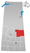
Smeaton (2016 population: 182) is a village in the Canadian province of Saskatchewan within the Rural Municipality of Torch River No. 488 and Census Division No. 14. It is at the foot of Hanson Lake Road, which ends at Creighton near Flin Flon, Manitoba). Narrow Hills Provincial Park is 70 km north.

History

Smeaton incorporated as a village on March 7, 1944.[1]

Demographics

Population history
(1981–2016)
YearPop.±%
1981246—    
1986300+22.0%
1991225−25.0%
1996192−14.7%
2001178−7.3%
2006183+2.8%
2011181−1.1%
2016182+0.6%
Source: Statistics Canada via Saskatchewan Bureau of Statistics[2][3]

In the 2021 Census of Population conducted by Statistics Canada, Smeaton had a population of 163 living in 69 of its 81 total private dwellings, a change of -10.4% from its 2016 population of 182. With a land area of 1.46 km2 (0.56 sq mi), it had a population density of 111.6/km2 (289.2/sq mi) in 2021.[4]

In the 2016 Census of Population, the Village of Smeaton recorded a population of 182 living in 73 of its 90 total private dwellings, a 0.5% change from its 2011 population of 181. With a land area of 1.48 km2 (0.57 sq mi), it had a population density of 123.0/km2 (318.5/sq mi) in 2016.[5]

See also

References

  1. ^ "Urban Municipality Incorporations". Saskatchewan Ministry of Government Relations. Archived from the original on October 15, 2014. Retrieved June 1, 2020.
  2. ^ "Saskatchewan Census Population" (PDF). Saskatchewan Bureau of Statistics. Archived from the original (PDF) on September 24, 2015. Retrieved May 31, 2020.
  3. ^ "Saskatchewan Census Population". Saskatchewan Bureau of Statistics. Retrieved May 31, 2020.
  4. ^ "Population and dwelling counts: Canada, provinces and territories, census divisions and census subdivisions (municipalities), Saskatchewan". Statistics Canada. February 9, 2022. Retrieved April 1, 2022.
  5. ^ "Population and dwelling counts, for Canada, provinces and territories, and census subdivisions (municipalities), 2016 and 2011 censuses – 100% data (Saskatchewan)". Statistics Canada. February 8, 2017. Retrieved May 30, 2020.

53°29′29″N 104°48′39″W / 53.49139°N 104.81083°W / 53.49139; -104.81083


Prefix: a b c d e f g h i j k l m n o p q r s t u v w x y z 0 1 2 3 4 5 6 7 8 9

Portal di Ensiklopedia Dunia

Kembali kehalaman sebelumnya